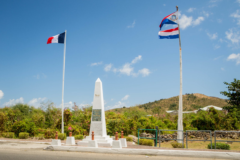
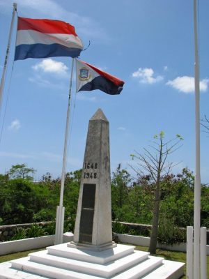
Zuständige deutsche Vertretung in der Region 🇩🇪
Bildquelle/n:
- Plakette: Deutsche Botschaft: Tohaomg, Wikimedia Commons | CC BY-SA 4.0 International
Bildquelle/n:
- Plakette: Deutsche Botschaft: Tohaomg, Wikimedia Commons | CC BY-SA 4.0 International
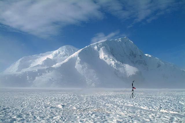
Maximale Erhebung
Bildquelle/n:
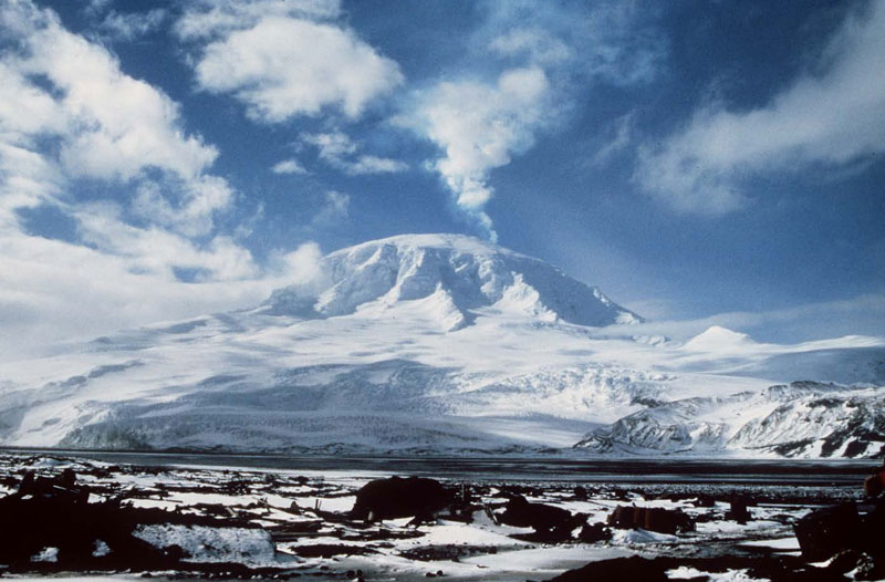
- Bild: Lars Christensentoppen auf der Peter-I.-Insel: 2006 Ham Radio DXpedition to Peter One | All Rights Reserved
Bildquelle/n:
- Bild: Lars Christensentoppen auf der Peter-I.-Insel: 2006 Ham Radio DXpedition to Peter One | All Rights Reserved
Fläche

Bildquelle/n:
- Karte: Heard- und McDonald-Inseln: Australian Antarctic Data Centre | CC BY 4.0 International
Bildquelle/n:
- Karte: Heard- und McDonald-Inseln: Australian Antarctic Data Centre | CC BY 4.0 International
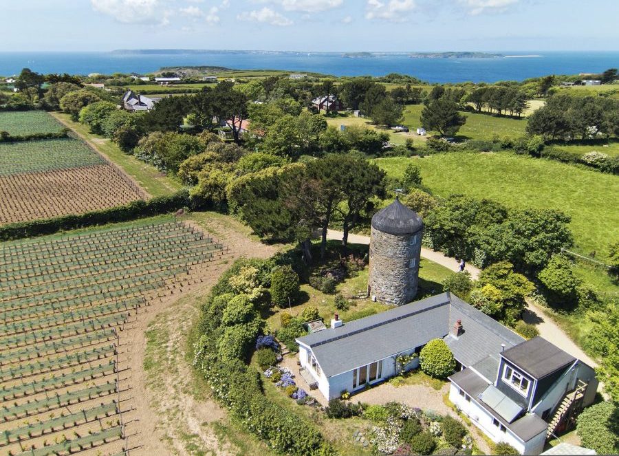
Maximale Erhebung
Bildquelle/n:
- Bild: unbenannte Erhebung bzw. Le Moulin in Anlehnung auf Sark: Kevin, Flickr (per E-Mail) | All Rights Reserved
Bildquelle/n:
- Bild: unbenannte Erhebung bzw. Le Moulin in Anlehnung auf Sark: Kevin, Flickr (per E-Mail) | All Rights Reserved
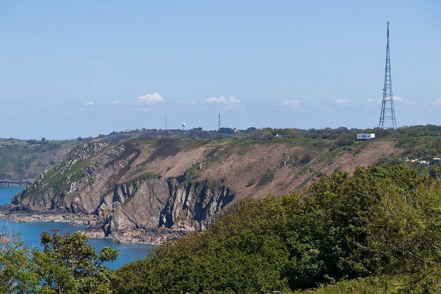
Maximale Erhebung
Bildquelle/n:
- Bild: Les Platons/Les Platons (Les Pliatons) im Hintergrund mit Radar- und Radiosendeanlagen auf Jersey: Danrok, Wikimedia Commons | CC BY-SA 4.0 International
Bildquelle/n:
- Bild: Les Platons/Les Platons (Les Pliatons) im Hintergrund mit Radar- und Radiosendeanlagen auf Jersey: Danrok, Wikimedia Commons | CC BY-SA 4.0 International
Maximale Erhebung
Bildquelle/n:
- Bild: Mawson Peak bzw. Mount Mawson („Big Ben“): Commonwealth of Australia (Geoscience Australia) | CC BY 4.0 International
Bildquelle/n:
- Bild: Mawson Peak bzw. Mount Mawson („Big Ben“): Commonwealth of Australia (Geoscience Australia) | CC BY 4.0 International
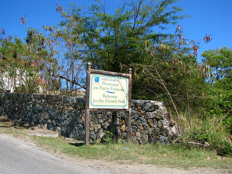
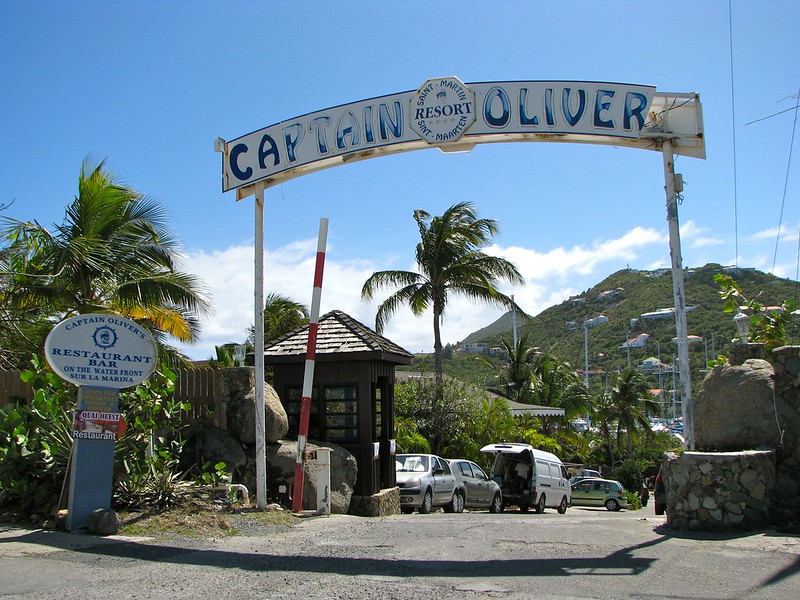
Grenzen
Bildquelle/n:
- Bild: Grenzüberquerung auf der A. T. Illidge Road mit Border Monument von Belle Plaine/Poumou/Quartier d‘Orleans, Saint-Martin nach Belvedere, Sint Maarten 🇸🇽: Marc YOKOHAMA, Flickr | CC BY-NC-ND 2.0 Generic
- Bild: Grenzüberquerung von Bellevue, Saint-Martin nach Cole Bay/Koolbaai, Sint Maarten (Rue Hollande/Union Road mit Grenzmarkierung): howderfamily.com, Flickr | CC BY-NC-SA 2.0 Generic
- Bild: Grenzüberquerung auf der Oyster Pond Road: howderfamily.com, Flickr | CC BY-NC-SA 2.0 Generic
- Bild: Grenzüberquerung am Oyster Pond: howderfamily.com, Flickr | CC BY-NC-SA 2.0 Generic
- Bild: Captain Oliver’s Resort auf der französischen Seite, das Restaurant und die Marina auf der niederländischen Seite: howderfamily.com, Flickr | CC BY-NC-SA 2.0 Generic
Maximale Erhebung
Bildquelle/n:
- Bild: Marigot (Marrgot) mit Pic Paradis bzw. Pic du Paradis/Paradise Peak/Pic Paradise (Mitte links) auf Saint-Martin: CruiseMapper.com | All Rights Reserved
Bildquelle/n:
- Bild: Marigot (Marrgot) mit Pic Paradis bzw. Pic du Paradis/Paradise Peak/Pic Paradise (Mitte links) auf Saint-Martin: CruiseMapper.com | All Rights Reserved
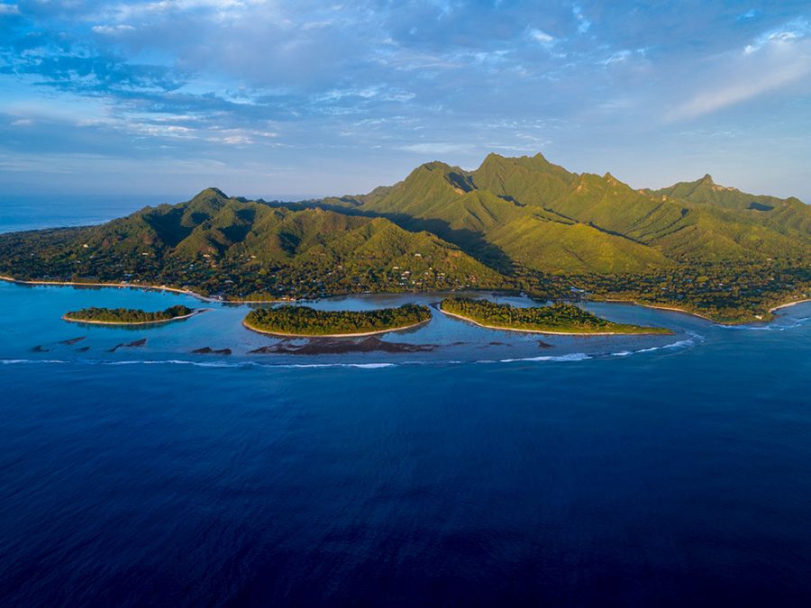
Fläche
Bildquelle/n:
- Bild: Cook-Inseln: Cook Islands Tourism Marketing Corporation (per E-Mail) | All Rights Reserved
Maximale Erhebung
Bildquelle/n:
- Bild: Te Manga: David KIRKLAND, Cook Islands Images | All Rights Reserved
Bildquelle/n:
- Bild: Te Manga: David KIRKLAND, Cook Islands Images | All Rights Reserved
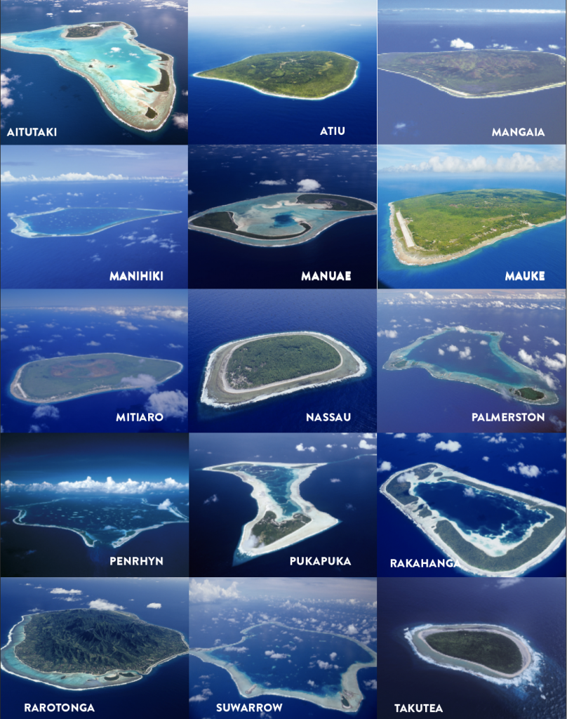
Verwaltungsgliederung

Bildquelle/n:
- Flagge: Aitu: Arnaud LEROY, FOTW Flags of the World | All Rights Reserved
- Sportflagge: Aitutaki: Jason SABER, FOTW Flags of the World
- Sportflagge: Aitu: Jason SABER, FOTW Flags of the World | All Rights Reserved
- Sportflagge: Mangaia: Jason SABER, FOTW Flags of the World | All Rights Reserved
- Sportflagge: Manihiki: Jason SABER, FOTW Flags of the World | All Rights Reserved
- Sportflagge: Mauke: Jason SABER, FOTW Flags of the World | All Rights Reserved
- Sportflagge: Mitiaro: Jason SABER, FOTW Flags of the World | All Rights Reserved
- Sportflagge: Palmerston Atoll: Jason SABER, FOTW Flags of the World | All Rights Reserved
- Sportflagge: Pukapuka: Jason SABER, FOTW Flags of the World | All Rights Reserved
- Sportflagge: Rakahanga: Jason SABER, FOTW Flags of the World
- Flagge: Rakahanga-Manihiki: Chrystian KRETOWICZ, FOTW Flags of the World | All Rights Reserved
- Sportflagge: Rarotonga: Jason SABER, FOTW Flags of the World | All Rights Reserved
- Sportflagge: Tongareva: Jason SABER, FOTW Flags of the World | All Rights Reserved
Maximale Erhebung
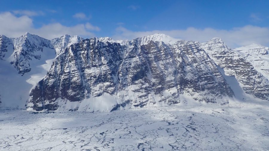
Bildquelle/n:
- Bild: Gunnbjørn bzw. Gunnbjørns Fjeld auf der Hauptinsel Grönland: NASA ICE, Wikipedia | CC BY 2.0 Generic
Bildquelle/n:
- Bild: Gunnbjørn bzw. Gunnbjørns Fjeld auf der Hauptinsel Grönland: NASA ICE, Wikipedia | CC BY 2.0 Generic
Verwaltungsgliederung

Fläche
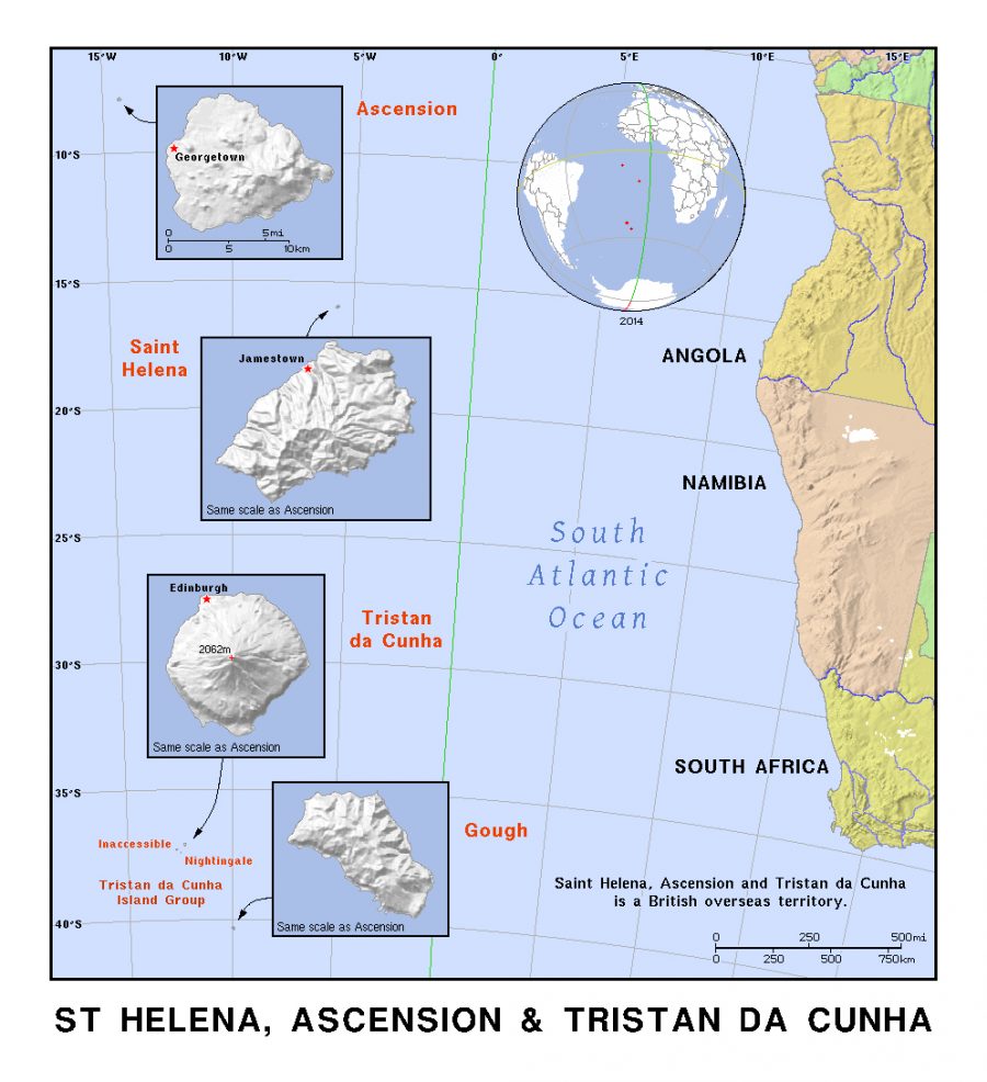
Bildquelle/n:
- Karte: Sankt Helena, Ascension und Tristan da Cunha: Mapsland | CC BY-SA 3.0 Unported
Maximale Erhebung

Verwaltungsgliederung

Bildquelle/n:
- Icon: Normale oder De-jure-Version einer Flagge: DoktorMandrake, Wikimedia Commons | CC BY 3.0 Unported
- Icon: Bürgerliche Flagge sowie Dienstflagge an Land und zur See: Wikimedia Commons | Public
Bildquelle/n:
- Icon: Normale oder De-jure-Version einer Flagge: DoktorMandrake, Wikimedia Commons | CC BY 3.0 Unported
- Icon: Bürgerliche Flagge sowie Dienstflagge an Land und zur See: Wikimedia Commons | Public Domain Mark 1.0
Maximale Erhebung
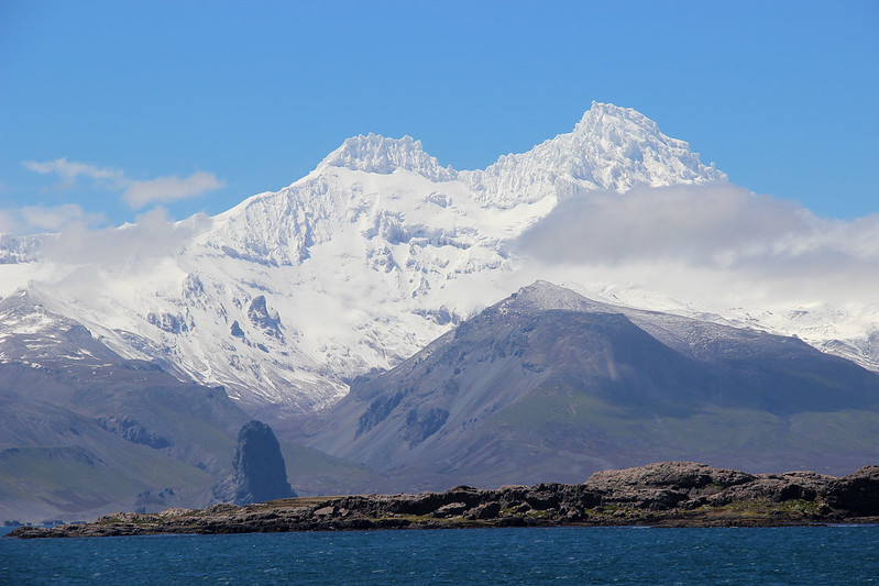
Bildquelle/n:
- Bild: Mont Ross: Nelly GRAVIER/Communication TAAF, Flickr | All Rights Reserved
Bildquelle/n:
- Bild: Mont Ross: Nelly GRAVIER/Communication TAAF, Flickr | All Rights Reserved
Maximale Erhebung
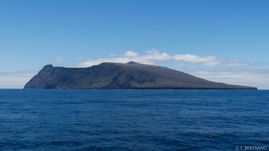
Bildquelle/n:
- Bild: Amsterdam-Insel mit dem Mont de la Dives: Yann BERTRAND (per E-Mail) | All Rights Reserved
Bildquelle/n:
- Bild: Amsterdam-Insel mit dem Mont de la Dives: Yann BERTRAND (per E-Mail) | All Rights Reserved
Maximale Erhebung
Bildquelle/n:
- Bild: Mont Marion-Dufresne auf der Ost-Insel: Nelly GRAVIER, Communication TAAF | All Rights Reserved
Bildquelle/n:
- Bild: Mont Marion-Dufresne auf der Ost-Insel: Nelly GRAVIER, Communication TAAF | All Rights Reserved
Maximale Erhebung
Bildquelle/n:
- Bild: Crocus Hill: Anguilla Tourist Board (per E-Mail) | All Rights Reserved
Bildquelle/n:
- Bild: Crocus Hill: Anguilla Tourist Board (per E-Mail) | All Rights Reserved
Maximale Erhebung
Bildquelle/n:
- Bild: Sero Jamanota: Michael SALAZAR, Aruba Tourism Authority (ATA) | All Rights Reserved
Bildquelle/n:
- Bild: Sero Jamanota: Michael SALAZAR, Aruba Tourism Authority (ATA) | All Rights Reserved
Maximale Erhebung
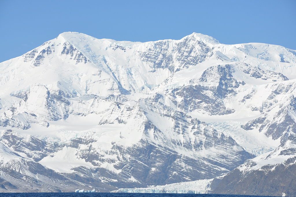
Bildquelle/n:
- Bild: Mount Paget auf Südgeorgien: Butterfly austral, Wikimedia Commons | CC BY-SA 3.0 Unported
Bildquelle/n:
- Bild: Mount Paget auf Südgeorgien: Butterfly austral, Wikimedia Commons | CC BY-SA 3.0 Unported
Fläche
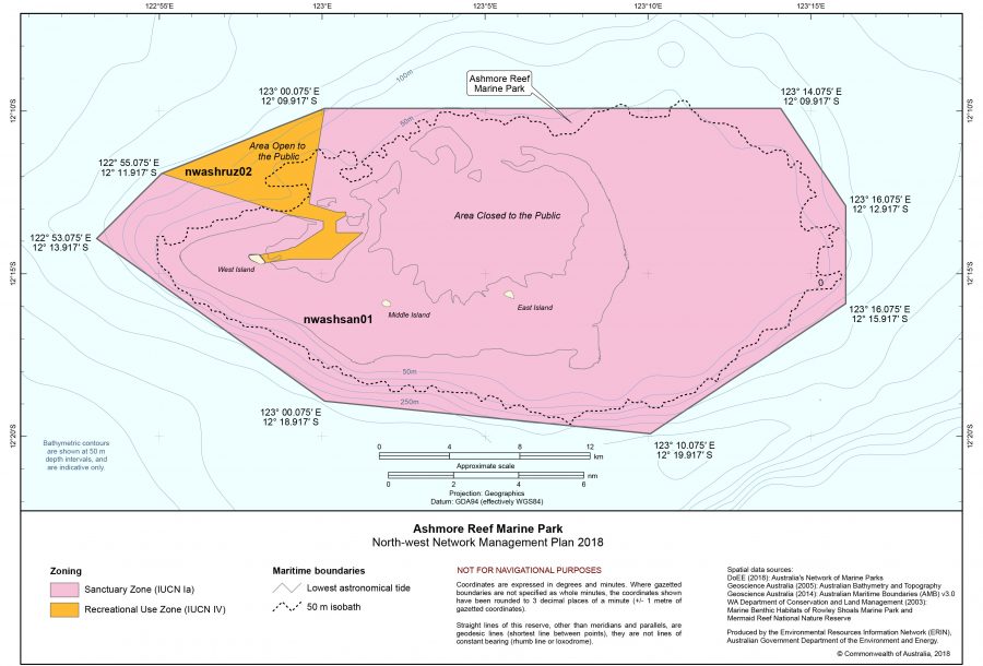
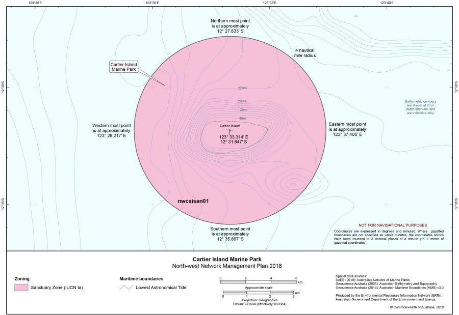
Bildquelle/n:
- Karte: Ashmore-Riff mit Ashmore-Inseln: Environmental Resources Information Network (ERIN), Department of the Environment and Energy, Australian Government | All Rights Reserved
- Karte: Cartier-Insel: Environmental Resources Information Network
Bildquelle/n:
- Karte: Ashmore-Riff mit Ashmore-Inseln: Environmental Resources Information Network (ERIN), Department of the Environment and Energy, Australian Government | All Rights Reserved
- Karte: Cartier-Insel: Environmental Resources Information Network (ERIN), Department of the Environment and Energy, Australian Government | All Rights Reserved
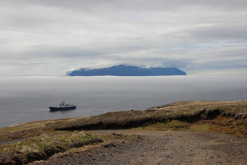
Maximale Erhebung
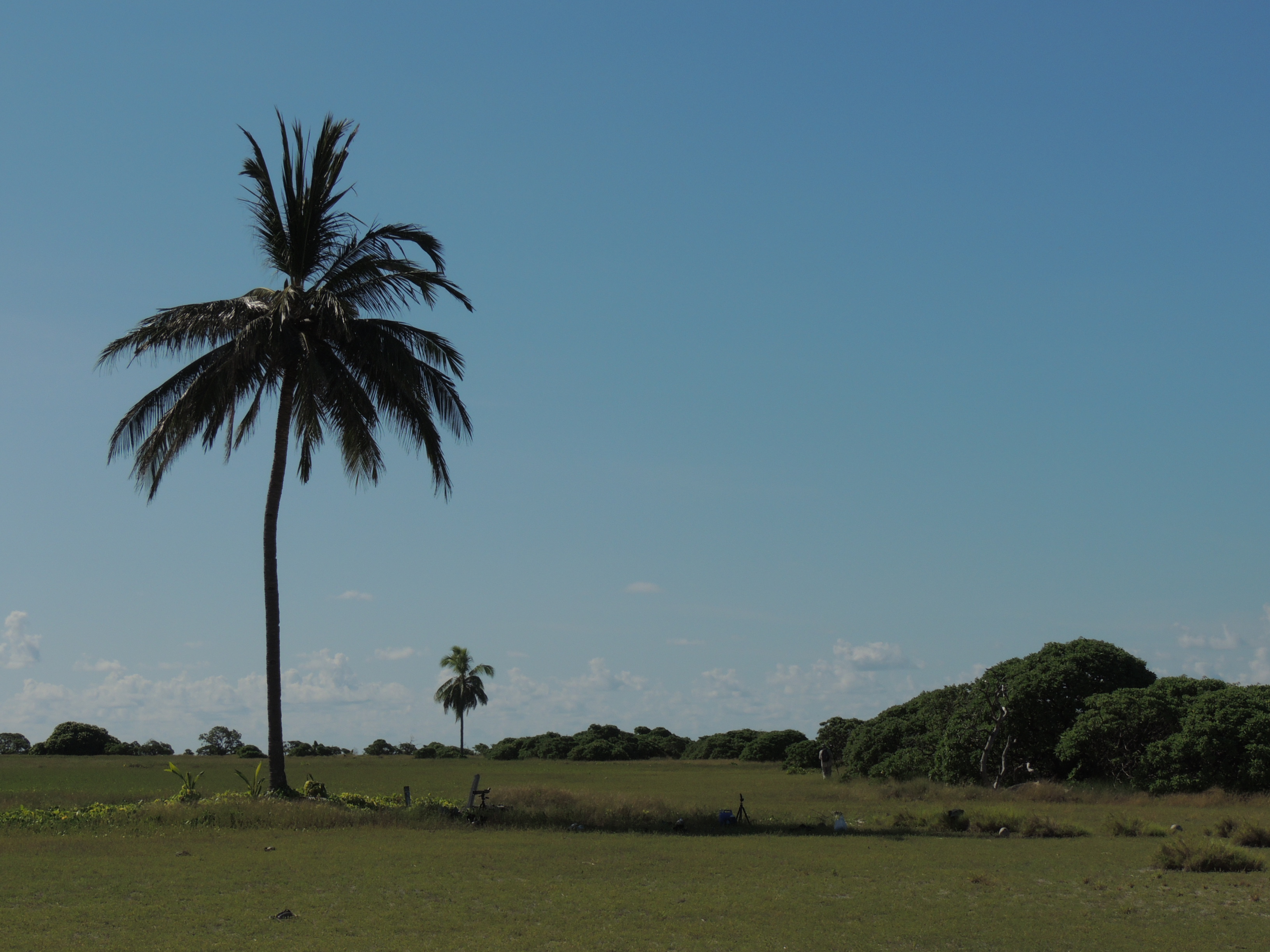
Bildquelle/n:
- Bild: West-Insel der Ashmore-Inseln: Roman BRUEHWILER (per E-Mail) | All Rights Reserved
Bildquelle/n:
- Bild: West-Insel der Ashmore-Inseln: Roman BRUEHWILER (per E-Mail) | All Rights Reserved
Maximale Erhebung
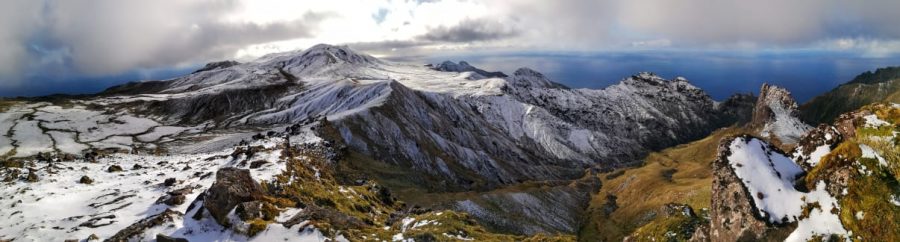
Bildquelle/n:
- Bild: Edinburgh Peak: Antarctic Legacy of South Africa (ALSA) (per E-Mail) | All Rights Reserved
Bildquelle/n:
- Bild: Edinburgh Peak: Antarctic Legacy of South Africa (ALSA) (per E-Mail) | All Rights Reserved
Neueste Kommentare